
Tekinkéecet Waq'iswíitoqt
The Dworshak Wildlife Habitat Mitigation Project
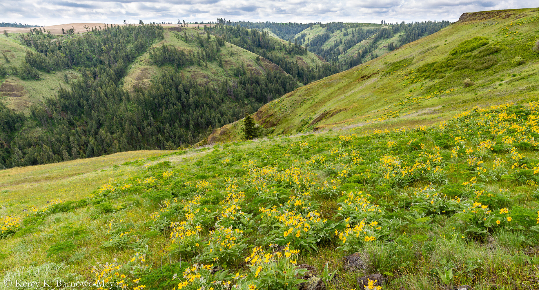
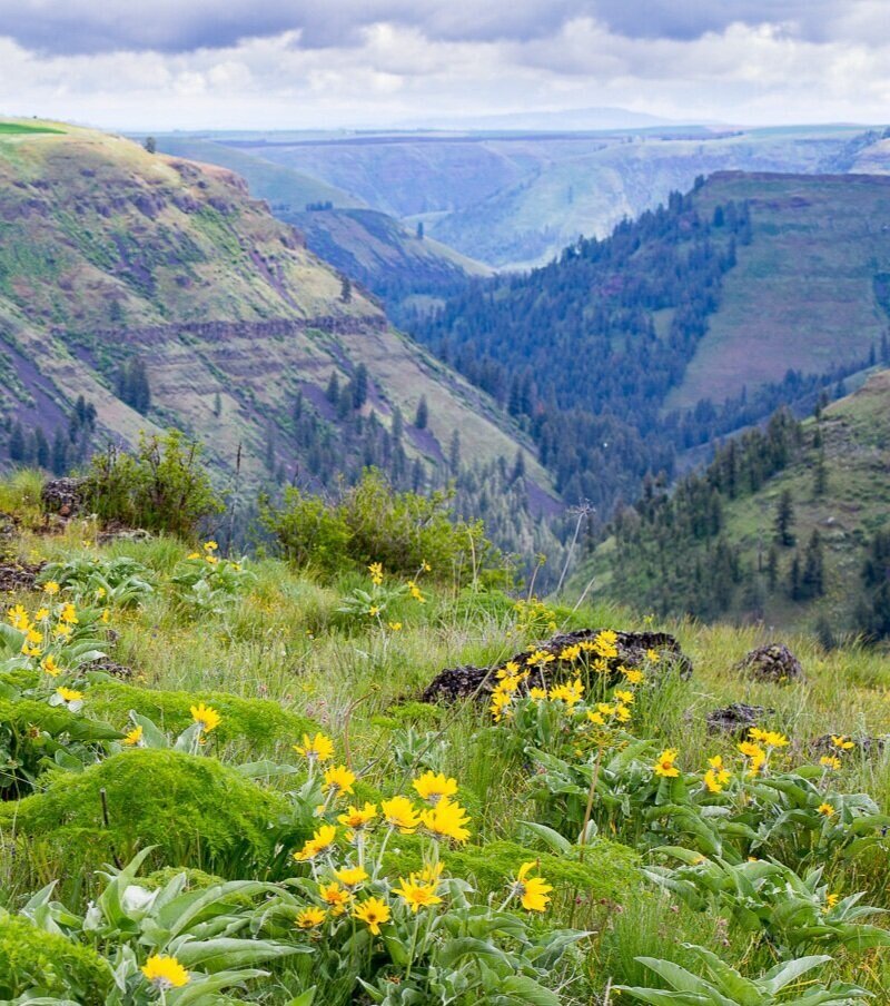
The construction of Dworshak Dam on the North Fork Clearwater River inundated over 17,000 acres of habitat for a wide variety of native plants and wildlife, including prime winter range for white-tailed deer, mule deer, and elk. The Nez Perce Tribe owns and manages a network of wildlife conservation areas to partially mitigate, or offset, this loss of habitat. Initiated in 1992, the Tribe now manages over 7,800 acres across five management units within the lower Clearwater River basin.
The Tribe’s Tekinkéecet Waq'iswíitoqt Wildlife Conservation Areas are managed to maintain, restore, and enhance native ecosystems as well as to provide appropriate cultural and recreational opportunities for Tribal members and the general public. All visitors are welcome!
Many of these lands were heavily degraded prior to reacquisition by the Tribe. Restoring them will require time, patience, and careful stewardship. Efforts are underway to rehabilitate previously farmed or degraded land to native wildlife and plant habitat. Eradication of invasive weeds, a common management challenge throughout our region, is being pursued using a combination of chemical, mechanical, bio-control, and ecological approaches.
Please observe and respect all posted signs and rules. These lands are culturally important to the Nimiipuu; please treat them with care during your visit.

Heyéeq’sin’me
This 540-acre area was dominated by agricultural fields before restoration was initiated in 2002. Today, visitors will find a patchwork of young forest, grasslands, riparian communities, and active agricultural fields targeted for restoration in the near future. Watch out for teasel! Long-term management goals for the Heyéeq’sin’me WCA include reestablishing native ponderosa pine forests, mixed grass/forb/shrub communities, and riparian shrub corridors in formerly-tilled areas as well as a frequent but low-severity wildfire regime.
Public access is readily available from Kettenbach Rd. and George Grade Rd. west of Gifford, ID.

Hińawíta
The Tribe’s largest WCA consists of approximately 3,320 acres within the lower Sixmile Creek watershed northeast of Nezperce, ID. This reserve contains a diverse mix of canyon grasslands, Douglas-fir and ponderosa pine forests, riparian communities, and abandoned homesteads. Long-term management goals for the Hińawíta WCA including reestablishing native ponderosa pine, Douglas-fir, and grassland communities in formerly-tilled areas, improving forest and grassland health, reestablishing historic forest structure, and restoring a mixed-frequency and -severity wildfire regime.
Public access to this area is available via US-12 from the east, Basket Rd. from the northwest, and Ewing Rd. from the southwest. Winter visitation and antler hunting are discouraged to protect wintering deer and elk.
Iceyéeyenm Hipinwées
“Coyote’s Table” consists of approximately 800 acres within the lower Posthole Creek watershed. Restoration of formerly-homesteaded and tilled areas commenced in 2001. Today, visitors will find a mosaic of canyon grasslands, forested slopes, and recently-planted forest stands. The long-term management goal for the Iceyéeyenm Hipinwées WCA is to reestablish native ponderosa pine and Douglas-fir forests, open grassland communities, and riparian shrub corridors and restore a mixed-frequency and -severity wildfire regime.
Public access is provided from Airport Rd. north of Craigmont, ID. Much of this WCA was burned in the Fisher Fire of 2015, and visitors should be cautious of falling trees and unstable soils.

Texséhe
This large WCA consists of approximately 2,100 acres of canyon grasslands, mixed Douglas-fir and ponderosa pine forests, abandoned homesteads, and active agricultural fields within the lower Bedrock and Louse Creek watersheds west of Cavendish, ID. Long-term management goals for the Texséhe WCA including reestablishing native ponderosa pine and western larch at key sites, restoring native habitat on currently- and formerly-tilled fields, improving forest and grassland health, and restoring a mixed-frequency and -severity wildfire regime.
Public access to this WCA is difficult and best achieved from Driscoll Rd. in the northeast corner of the property. Much of this WCA was burned in the Bedrock Fire of 2021, and visitors should be extremely cautious of falling trees and unstable soils. Winter visitation and antler hunting are discouraged to protect wintering deer and elk.

Túkéespe
Approximately 995 acres in size, much of this area on Cream Ridge was already enrolled in CRP before supplemental restoration was initiated in 2005. Today, visitors will find a patchwork of young forest, grasslands, and riparian communities as well as active agricultural fields. This WCA’s name references an area near the base of Cream Ridge where meat was historically dried. Long-term management goals for the Túkéespe WCA include reestablishing native ponderosa pine, Douglas-fir, and grassland communities and restoring a mixed-frequency and -severity wildfire regime.
Public access is readily available from Cream Ridge Rd. southwest of Cavendish, ID. Areas north of Cream Ridge Road within this WCA were burned in the Bedrock Fire of 2021, and visitors should be extremely cautious of falling trees and unstable soils, particularly within Louse Creek canyon.
2021 Bedrock Fire
The Bedrock Fire started the afternoon of Wednesday, August 11th near the mouth of Bedrock Creek along the Clearwater River. Winds pushed the fire rapidly east and northward, threatening the town of Lenore. By midday Friday, the fire had burned to the mouth of Louse Creek. Strong winds late Friday pushed the fire eastward, consuming virtually all of Louse Creek including those areas within the Texséhe and Túkéespe Wildlife Conservation Areas. By early Sunday, much of the remaining canyon portions of the Bedrock Creek watershed had burned as well.
Within the Túkéespe WCA north of Cream Ridge Road, the majority of trees and vegetation were killed by the Bedrock Fire or a backburn set by suppression crews. The canyon portion in Louse Creek burned extremely hot, with essentially no overstory trees left alive. Within the Texséhe WCA, the fire completely eliminated most live canopy cover in Louse Creek and functionally all of it in Bedrock Creek. This included most of the riparian areas as well, except for the lower-most portions of Louse and Bedrock Creek. It also appears to have included most of the western larch, western red cedar, and Pacific yew in Bedrock Creek. The old house on the western field within the the Texséhe WCA was lost. Fortunately, many west-facing stands (a small minority of the total area) burned at lower severity, and healthy ponderosa pine and Douglas-fir are still present in many of those areas.
Within much of Bedrock and Louse Creek canyons, the fire burned with moderate to severe intensity due to a combination of extremely dry conditions, favorable winds and topography, and relatively high fuel loads in many areas. But the conditions were such that even well-spaced trees, stands with open understories, wet riparian areas, and isolated trees surrounded by rock fields all burned intensely. Ironically, a partnership project involving the Wildlife and Forestry & Fire Management Divisions to reduce fuels and enhance wildlife habitat was scheduled to begin within the Texséhe WCA just months later.

Louse Creek Canyon looking northwest following the Bedrock Fire (photo taken 9/3/2021).